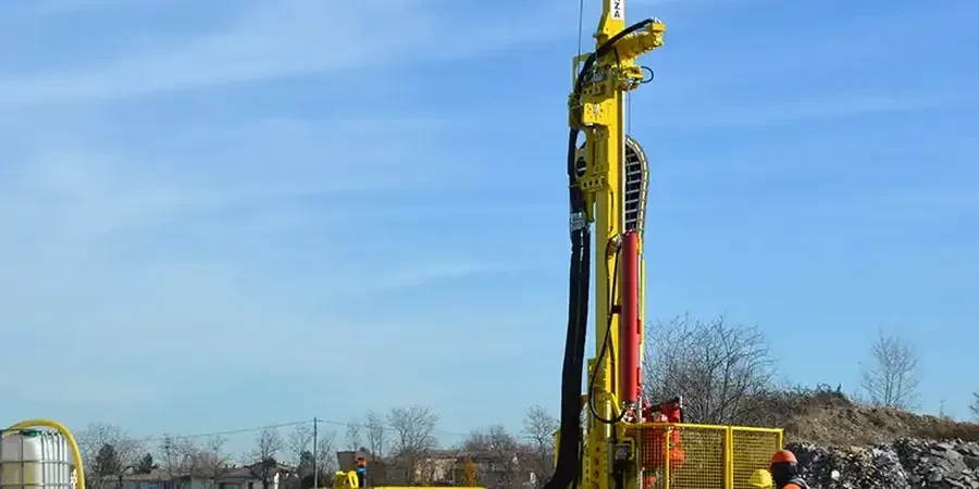
In Boise, geotechnical investigation forms the bedrock of safe, compliant, and cost-effective construction. This category encompasses all field and laboratory methods used to characterize subsurface soil, rock, and groundwater conditions before design begins. From residential additions in the North End to multi-story commercial structures downtown, understanding what lies beneath the surface is not optional—it is a fundamental engineering requirement. The scope of a proper investigation includes drilling, sampling, in-situ testing, and geophysical surveys, each tailored to the specific site and proposed structure.
The Treasure Valley presents a unique geological setting that directly shapes investigation strategies. Boise sits on a complex mix of Quaternary alluvial fan deposits from the Boise Front, interbedded with lake sediments from ancient Lake Idaho. Near the Boise River, loose to medium-dense sands and gravels dominate, while foothill areas may encounter shallow basalt bedrock or expansive clay layers. Groundwater depth varies seasonally and can be encountered within 10 to 30 feet in many parts of town, influencing foundation type and excavation planning. These conditions demand a rigorous, site-specific approach rather than reliance on regional assumptions.
Investigations in Boise must align with the current International Building Code (IBC) as adopted by the City of Boise, which references ASCE 7 for seismic site classification and foundation design parameters. The Idaho Board of Professional Engineers and Professional Land Surveyors governs licensing requirements, mandating that all geotechnical reports be stamped by a registered Professional Engineer. Additionally, the Idaho Transportation Department (ITD) maintains specific investigation standards for public roadway and bridge projects, often requiring deeper borings and specialized testing such as the CPT (Cone Penetration Test) for liquefaction assessment in alluvial zones.
Projects that routinely trigger a formal geotechnical investigation include new commercial construction, subdivisions, retaining walls over four feet, and any structure requiring a building permit in areas of mapped geologic hazard. Critical infrastructure such as schools, hospitals, and emergency response facilities face enhanced scrutiny under Idaho’s seismic design categories, often necessitating advanced testing like downhole shear wave velocity measurements. Even smaller residential projects benefit from a targeted investigation, particularly where expansive soils or shallow groundwater are suspected, helping avoid costly foundation repairs down the road.
Available services
Common questions
When is a geotechnical investigation required in Boise?
A geotechnical investigation is typically required for any new commercial or multi-family construction, subdivisions, public infrastructure, and residential projects in mapped hazard zones. The City of Boise enforces IBC Chapter 18, which mandates a subsurface exploration report for structures not exempted under light-frame residential provisions. Site-specific triggers include slopes over 15%, liquefaction-prone soils, and expansive clay areas.
What local soil conditions most affect foundation design in the Treasure Valley?
Boise’s subsurface is dominated by alluvial sands and gravels near the river, with potential for liquefaction in seismic events. Foothill areas often contain expansive clays that swell when wet and shrink during dry periods, damaging shallow foundations. Shallow basalt bedrock can also complicate excavation. Groundwater levels fluctuate seasonally, influencing bearing capacity and requiring careful drainage planning in many parts of the city.
How long does a typical geotechnical investigation take in Boise?
Fieldwork for a standard commercial lot usually takes one to three days, depending on access and drilling depth. Laboratory testing adds one to two weeks, and report preparation typically requires another week. Complex projects involving deep foundations or seismic site classification may extend the timeline to four to six weeks. Permitting and utility locating can also affect scheduling, especially during Boise’s busy construction season.
What are the most common in-situ tests used during Boise investigations?
Standard Penetration Tests (SPT) remain the most common method for soil sampling and relative density estimation. For finer stratigraphic detail and liquefaction analysis, the Cone Penetration Test (CPT) is increasingly specified, particularly along the Boise River corridor. Other frequent tests include vane shear for soft clays, pressuremeter tests for modulus values, and downhole seismic methods when site class determination is critical under ASCE 7.