When a developer broke ground on a new mixed-use project near the Boise River last spring, the geotechnical investigation revealed something unexpected: the depth to competent basalt varied by over 25 feet across a single city block. Standard borings alone could not connect the dots between the drill holes, so the design team commissioned a seismic refraction tomography survey to create a continuous subsurface velocity model that mapped the bedrock surface in three dimensions. This is the kind of problem seismic tomography solves every day in Boise, where the transition from river-deposited sediments to the underlying basalt flows of the Snake River Plain can shift rapidly and without surface indication. The technique generates a detailed cross-section of compressional and shear wave velocities, which geotechnical engineers use to interpret stratigraphy, estimate rippability, and position critical foundation elements with confidence that discrete borings simply cannot provide on their own.
In Boise's basin-edge environment, seismic tomography consistently identifies velocity contrasts that conventional drilling misses between boreholes.
Our approach and scope
Local ground factors
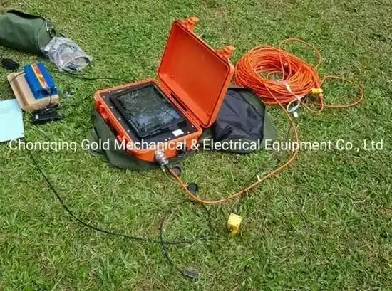
A seismic tomography crew working in Boise deploys a spread of geophones connected by a seismograph that records first-arrival travel times and, in reflection mode, later-arriving reflected phases from subsurface impedance contrasts. The field operation requires a clear, relatively straight alignment free of asphalt that would prevent geophone coupling, which means surveys in developed parts of downtown often use park strips or closed traffic lanes. The single greatest source of interpretation uncertainty in the Treasure Valley is the velocity overlap between dense, dry gravels and weathered basalt, both of which can register around 6,000 to 8,000 ft/s. Our processing workflow uses iterative ray-tracing inversion that starts from a layered initial model constrained by any available borehole data, then progressively relaxes the layering assumption to produce a smooth velocity field that honors the actual ray paths. When a project deadline depends on bedrock depth confirmation for foundation design, skipping the tomography step and relying solely on widely spaced borings introduces a risk of over-excavation or, worse, placing footings on material that looks competent but sits above an unseen low-velocity zone.
Relevant standards
The survey adheres to ASTM D5777-18, ASCE 7-22 for site class determination via Vs30, and IBC 2021 Chapter 16 seismic site classification requirements.
Other technical services
Seismic Refraction Tomography for Bedrock and Rippability
Designed for projects that need to map the top of basalt bedrock, evaluate excavation difficulty, or locate paleochannels in the Boise River floodplain. The survey produces a continuous velocity section that classifies subsurface materials by seismic velocity and identifies zones where mechanical ripping is feasible versus where blasting may be required.
High-Resolution Reflection Surveys for Basin Structure
Applied when investigating deeper basin architecture, fault geometry, or the continuity of aquitards beneath the Treasure Valley. This method captures reflected energy from velocity boundaries at depths beyond the reach of standard refraction, making it valuable for groundwater modeling studies and seismic hazard assessments tied to the Boise Fault system.
Typical parameters
Common questions
What is the typical cost of a seismic tomography survey in Boise?
How does seismic tomography compare to drilling alone for bedrock mapping?
Drilling gives you a point measurement at the borehole location, while seismic tomography gives you a continuous velocity profile between those points. In Boise, where basalt topography can be highly irregular, combining the two methods reduces the risk of misinterpreting the bedrock surface and avoids costly surprises during excavation.
Can you perform surveys on paved surfaces in downtown Boise?
Geophones need direct ground coupling, so asphalt and concrete must be removed or avoided. On urban sites, we typically use adjacent unpaved strips, landscaped areas, or coordinate temporary traffic control to occupy a lane. The survey design adapts to available space without compromising data quality.
What seismic site class does Boise typically fall into?
Site class varies considerably across the city. Much of the valley floor falls into Site Class D, but areas near the Boise Foothills where shallow basalt is present can qualify as Site Class C. A combined refraction and MASW survey provides the Vs30 measurement needed to confirm the correct classification per ASCE 7 and the IBC. More info.