Boise sits on a mix of fluvial terrace deposits and fractured basalt from the Columbia River Basalt Group, which means the subsurface response can shift dramatically within a single block. We have seen retaining walls on the Bench deflect more than predicted because the design assumed uniform soil stiffness, and the only way to catch that is with real-time geotechnical instrumentation. Before we finalize any monitoring plan, we usually cross-check the stratigraphy with a dilatometer test to get a continuous stiffness profile, and we also run [MASW surveys](/masw-vs30/) to map Vs30 variations across the site. Those two readings together tell us where to place inclinometers and piezometers so we are not guessing at the critical zones.
Real-time geotechnical instrumentation catches movement before it becomes a crack: a single inclinometer reading can prevent a retaining wall failure on Boise's Bench.
Methodology and scope
Local considerations
The biggest risk we see in Boise is installing instrumentation without understanding the local groundwater regime. If you drill a piezometer casing through a perched water table above the basalt layer and do not seal the annulus with bentonite, you will get a false reading that looks like a deep aquifer. We use tremie-grouted seals and wait 24 hours for the bentonite to hydrate before taking baseline readings. Another common issue is placing inclinometer casings too close to construction equipment vibration, which introduces noise that masks real slope movement. We always locate the casing at least 10 feet from the active haul road and backfill the annulus with a cement-bentonite slurry that matches the soil stiffness.
Explanatory video
Applicable standards
ASCE 7-22 (Minimum Design Loads and Risk Category), IBC 2021 Chapter 18 (Soils and Foundations), ASTM D6230-21 (Inclinometer Testing), ASTM D5092-16 (Piezometer Installation), FHWA NHI-05-037 (Instrumentation for Geotechnical Applications)
Associated technical services
Inclinometer Design and Installation
Grooved casing, shape-array or in-place sensors, automated data collection with cloud alerts for slope displacement exceeding 0.1 inches per month.
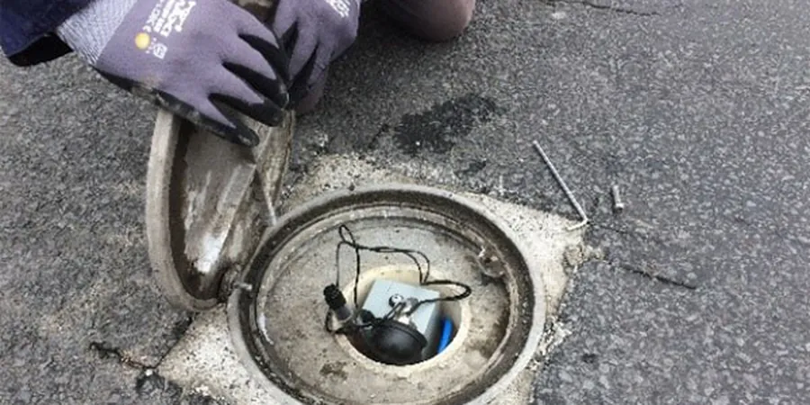
Piezometer Networks
Vibrating-wire and standpipe piezometers installed with bentonite seals, connected to dataloggers that transmit hourly readings via cellular modem.
Settlement Monitoring Systems
Surface monuments, liquid-level settlement cells, and extensometers to track vertical deformation during fill placement or excavation.
Load and Strain Gauges
Strain gauges on tiebacks, tell-tales on piles, and load cells under footings — all wired to a central data acquisition unit with remote access.
Typical parameters
Frequently asked questions
How much does geotechnical instrumentation design and installation cost in Boise?
For a typical hillside development or commercial project in Boise, the total cost ranges from US$2,530 to US$4,390 including casing, sensors, data logger, and one year of cloud monitoring. The exact price depends on the number of monitoring points, depth of borings, and whether you need real-time alerts.
How long does it take to install inclinometers and start collecting data?
Drilling and casing installation takes one to two days per borehole. After backfilling with cement-bentonite grout, we wait 24 hours for the grout to set, then take the first baseline reading. You start seeing usable displacement data within 48 to 72 hours from the start of drilling.
Which Boise soil conditions require the most instrumentation?
The Bench area, with its thick loess and colluvium over basalt, is prone to slow creep that inclinometers catch early. The alluvial terraces along the Boise River have variable sand and gravel layers where piezometers are essential to track perched water tables during excavation.