A common mistake we see with contractors new to Boise is assuming that any fill placed behind a retaining wall or along a roadway will simply stay put if compacted to standard Proctor. In the Treasure Valley, the alluvial and lacustrine deposits left by ancient Lake Bonneville create a highly variable moisture regime. What looks like competent clay at 12% moisture can turn into a low-strength slurry after a wet spring. For road embankment design, relying only on a basic sieve analysis misses the bigger picture. You need to understand how the fill behaves under long-term loading and seasonal saturation, which is why we always pair our embankment evaluations with a permeability test and a compression test to capture the stress-strain response at target densities.
Boise’s collapsible silt layer can trigger 10–15 cm of differential settlement after wetting if not accounted for in the embankment design.
Methodology and scope
- Maximum dry density and optimum moisture content (ASTM D698 / D1557)
- Direct shear strength of the native foundation soil (ASTM D3080)
- Consolidation parameters to estimate post-construction settlement
Local considerations
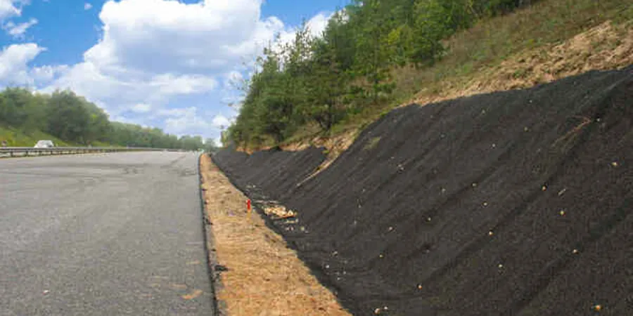
We evaluated a subdivision access road in southeast Boise where the contractor placed 4 m of fill directly on a silty clay without testing the foundation soil. After two freeze-thaw cycles and a wet March, the embankment developed a 30-cm vertical crack parallel to the shoulder. The root cause was undrained shear strength dropping below 25 kPa under the fill weight. A proper road embankment design would have required either a geogrid basal layer, a staged construction sequence, or a shallow soil improvement program. That project ended up costing 40% more than the original budget because of emergency stabilization work.
Applicable standards
ASCE 7-16 (Minimum Design Loads for Buildings and Other Structures – Seismic Earth Pressures), IBC 2021 (Section 1804 – Foundation and Embankment Criteria), ASTM D698 / D1557 (Standard Proctor Compaction Tests), FHWA-NHI-05-037 (Mechanistic-Empirical Design of New and Rehabilitated Pavements)
Associated technical services
Embankment Foundation Investigation
Combines test pits, SPT borings, and in-situ moisture-density testing to characterize the native soil profile before fill placement. We provide settlement estimates and bearing capacity recommendations tailored to the specific site conditions in Ada County.
Fill Material Selection & Compaction Control
We evaluate borrow sources for grain size, plasticity (Atterberg limits), and compaction characteristics. During construction, our field technicians perform nuclear density gauge tests to verify that each lift meets the target relative compaction of 95% of Standard Proctor.
Typical parameters
Frequently asked questions
What is the typical cost range for a road embankment design study in Boise?
For a standard residential or light commercial roadway project in the Treasure Valley, the geotechnical investigation and design report typically runs between US$1,380 and US$3,740. The final cost depends on the number of borings, laboratory tests required, and the complexity of the foundation soil conditions.
How deep do I need to excavate to remove collapsible soil before placing embankment fill?
In many parts of Boise, collapsible silts extend from the surface down to about 4–6 m. A full removal is rarely economical. Instead, we design the embankment with a moisture-conditioning program and a geogrid basal reinforcement layer. The exact depth of treatment is determined by a collapse potential test (ASTM D5333) on undisturbed samples.
What seismic design considerations apply to road embankments in Boise?
Boise falls into Seismic Design Category C per IBC 2021, with a mapped spectral acceleration Ss around 0.35g. For embankments higher than 6 m, we evaluate pseudo-static stability using a horizontal seismic coefficient of 0.1–0.15 times the peak ground acceleration. Liquefaction is not a major concern in the silt-dominated profiles, but lateral spreading along the Boise River corridor should be checked.
Can I use on-site soil from the excavation for the embankment fill?
Often yes, but it requires testing. The native silts and clays in Boise typically have plasticity indices between 10 and 20, which makes them suitable for embankment fill if compacted near optimum moisture. We run a Proctor compaction test and a direct shear test on the on-site material to confirm it meets the project specifications. If the soil has organic content above 1%, it will need to be wasted or blended with a granular borrow source.