A residential development on a steep lot near the Boise Foothills recently faced unexpected gully formation after a single spring rain. The contractor had cleared native sagebrush and cheatgrass without understanding the soil's low cohesion. A proper soil erosion analysis would have predicted the rapid runoff. In Boise, where the topography shifts abruptly from the Snake River Plain to the Front Range, erosion risk varies block by block. We combine field reconnaissance with the [Revised Universal Soil Loss Equation (RUSLE)](https://www.nrcs.usda.gov/resources/guides-and-instructions/revised-universal-soil-loss-equation-2-rusle2) to quantify sheet and rill erosion. For deeper gullies or streambank retreat along the Boise River, we supplement with slope stability modeling to evaluate whether undercutting could trigger a shallow landslide. Every report includes site-specific rainfall erosivity factors derived from NOAA Atlas 14 for Ada County.
Boise's semi-arid climate and foothills topography mean that a single thunderstorm can remove years of topsoil if erosion controls are not designed from the start.
Methodology and scope
Local considerations
The biggest risk in Boise is not the annual average but the 100-year storm event. A 2-inch downpour in one hour — which has a 1% annual exceedance probability — can mobilize cobbles on a 30% slope in the Foothills. Without a soil erosion analysis, developers often overestimate the capacity of silt fences and underdesign sediment basins. We have documented cases where a subdivision near Bogus Basin Road lost over 200 cubic yards of soil in a single weekend because the temporary drainage swales were not sized for the local IDF curve. Our analysis uses the Rational Method for peak discharge and the Modified Universal Soil Loss Equation (MUSLE) for sediment yield, ensuring that detention ponds meet the City of Boise's stormwater ordinance.
Applicable standards
IBC 2021 Chapter 18 (excavation, grading, and fill), ASCE 7-16 Section 2.4 (rain loads and hydrostatic pressure), ASTM D422 (particle-size analysis for sediment yield), City of Boise Stormwater Management Manual (2023)
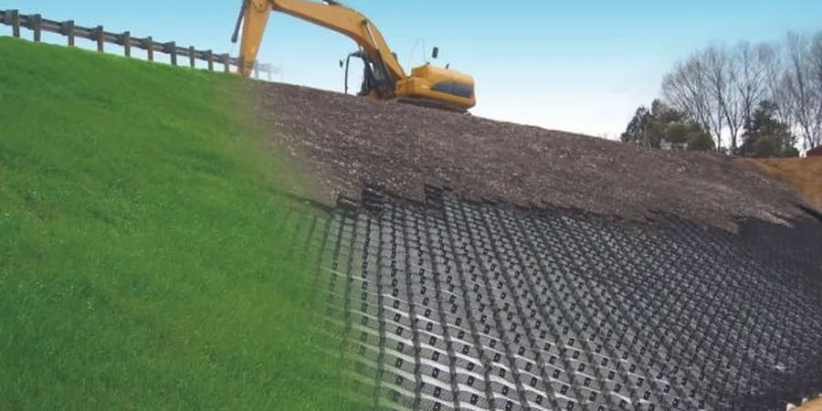
Associated technical services
RUSLE2 Modeling
Quantitative sheet and rill erosion estimates using the Revised Universal Soil Loss Equation version 2, calibrated with local rainfall data from the Boise Airport weather station.
Gully & Streambank Assessment
Field surveys of existing erosion features, including headcut migration rates and bank stability analysis using the Bank Stability and Toe Erosion Model (BSTEM).
Sediment Basin Design
Hydrologic and hydraulic design of temporary and permanent sediment basins per the City of Boise's 2023 Stormwater Management Manual, including dewatering times and cleanout schedules.
Post-Construction SWPPP Support
Review and preparation of Stormwater Pollution Prevention Plans for construction sites over one acre, with weekly inspection protocols and rain gauge installation.
Typical parameters
Frequently asked questions
When is a soil erosion analysis required in Boise?
The City of Boise requires an erosion and sediment control plan for any land-disturbing activity over one acre, or on slopes exceeding 15%. The analysis must be submitted with the grading permit application and must follow the 2023 Stormwater Management Manual. We recommend starting the study before site clearing to avoid delays.
How is the R-factor calculated for Boise?
The rainfall erosivity factor (R) is derived from NOAA Atlas 14 precipitation frequency estimates for Ada County. For the Boise area, the mean annual R-factor ranges from 45 to 65 (MJ·mm)/(ha·h·yr), but we use the 10-year storm event for design of temporary controls. Our reports include both the mean annual value and the design storm value.
What is the typical cost range for a soil erosion analysis in Boise?
For a standard residential lot in the Foothills, the cost ranges between US$940 and US$2,230, depending on lot size, slope complexity, and whether a sediment basin design is included. Commercial subdivisions with multiple drainage areas may be higher. We provide a fixed-price quote after a site visit.
Can erosion analysis be combined with a geotechnical investigation?
Yes. Many of our Boise clients request a combined scope that includes soil erosion analysis plus a geotechnical investigation for foundation design. The erosion component uses the same soil borings to determine texture and compaction, and the geotechnical report covers bearing capacity and settlement. Combining both saves time and reduces total cost.