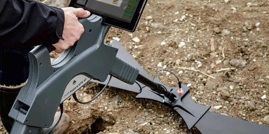
The GPR unit we bring to Boise sites is a shielded 400 MHz antenna system, towed behind a field engineer on a rugged cart. It sends electromagnetic pulses into the ground and records reflections from buried objects, soil layers, and bedrock. In Boise, where the Boise River floodplain meets granitic foothills, this non-invasive method quickly differentiates alluvial sands and gravels from deeper weathered bedrock. It is a first-pass tool that saves drilling costs and guides targeted invasive testing later. For projects near the Greenbelt or downtown infill lots, the survey covers linear feet rapidly without disrupting traffic or landscaping, producing real-time radargrams that the team interprets on-site.
In Boise's mixed alluvial environment, GPR often images paleochannels and buried debris that no surface inspection would ever reveal.
Methodology and scope
Local considerations
A common mistake we see in Boise is running a GPR survey in late spring, when the water table peaks and near-surface soils are saturated. Wet clay masks reflections and produces false negatives on utility lines. Another issue is assuming GPR alone can classify soil type. The radargram shows geometry but not density or strength. Without correlating with borings or standard penetration tests, the team risks misinterpreting a cobble layer as bedrock. We always advise scheduling dry-season surveys and pairing GPR with at least one direct sampling method.
Applicable standards
ASTM D6432-19 (Standard Guide for Using GPR), ASCE 38-22 (Standard Guideline for Subsurface Utility Engineering), OSHA 29 CFR 1926.651 (Excavation safety and utility location)
Associated technical services
Utility and Void Detection
Locates buried pipes, conduits, tanks, and unknown cavities beneath existing pavement or soil. Ideal for downtown Boise renovations where as-built records are incomplete.
Stratigraphic Profiling
Maps soil layers, bedrock depth, and paleochannels across large lots. Supports foundation design for subdivisions in the Meridian and Eagle areas.
Bridge and Pavement Assessment
Inspects deck delamination, rebar cover, and base course thickness on Boise's aging bridge structures and arterial roadways.
Typical parameters
Frequently asked questions
How deep can GPR penetrate in typical Boise soils?
Depth depends on soil conductivity. In the dry sands and gravels of South Boise, penetration often reaches 4 to 5 meters. In the clay-rich soils near the river or in the North End, useful signals rarely exceed 3 meters. We adjust antenna frequency on-site to balance depth and resolution.
Does GPR work in frozen or snow-covered ground?
Yes, GPR signals pass through dry snow and frozen soil with minimal attenuation. In Boise's winter conditions, we have successfully surveyed parking lots and open fields with a few centimeters of frost. Ice lenses can produce strong reflections that are easy to identify.
What is the typical cost range for a GPR survey in Boise?
For a standard commercial lot (0.5 to 2 acres), the survey typically falls between US$9,010 and US$1,110, depending on grid density and on-site interpretation requirements. Larger linear surveys along roads or pipelines are usually priced per linear foot.
How do you differentiate buried utilities from natural features on the radargram?
Utilities produce characteristic hyperbolic reflections, while natural layers show continuous planar reflectors. We also cross-reference with the city's utility maps and, if needed, use a signal injection clamp on live lines to confirm their position. The field engineer marks suspect features immediately for potholing.